

More items from this sellerView All


Adrena First without charts
 Supplier:
Softwares Aung
Supplier:
Softwares Aung
$720.19
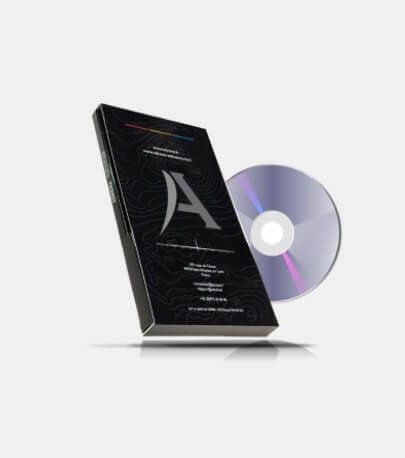
Adrena First software without cartography for navigation is an excellent route forecasting tool based on boat speed polars and weather.
The Adrena First software without included cartography is an excellent route planning tool based on the boat’s speed polars and weather conditions, providing assistance for offshore navigation. Developed by the Adrena team for Offshore Sailing, Adrena First is based on isochrone calculation for high precision.
It calculates the best possible route in terms of speed and safety using the following data: departure date and location, destination, boat speed polars, and wind conditions (in Grib format).
Software Functions
Navigation
Touchscreen mode usable on tablets.
Waypoint and route management.
Worldwide tide calculation.
Download of GRIB files via internet and email for up to 16 days.
Reading and display of GRIB files.
Meteograms.
Logbook (position, speed, wind).
MOB and AIS functions.
Safety alarms: MOB, AIS, approaching coast, anchoring.
Calculation and display of laylines.
Integration of currents in laylines and mark rounding times.
Race module: start, windward/leeward, and coastal courses.
Competitor tracking function.
IRC/HN compensated time calculation.
Racing
Competitor tracking function.
IRC/HN compensated time calculation.
Management of start, windward/leeward, and coastal courses.
Calculation and display of laylines.
Integration of currents in laylines and mark rounding times.
Performance analysis.
Calculation of real boat polars from navigation data.
Creation of polars by VPP.
Creation and modification of sail usage ranges (Sailect).
Performance tracking (VMG, target speed…).
Possibility to load traces for recording correction.
Routing
Calculation of the optimal route while automatically avoiding the coast.
Routing in 2 clicks.
Mixed sail/motor routing.
Integration of currents in routing calculations.
Routing calculation on a coastal route.
Imposed waypoint (pivot on isochrone).
Competitor routing.
Summary table of one or more routings.
Limitation of wind force and angle in routings.
Display of encountered wind conditions.
Function table.
System Requirements
Operating system: Windows 7, 8, or 10.
Screen: Minimum 1024×768.
NMEA 0183 connection via COM port, USB, or network.
Dedicated USB port for the dongle.
DVD drive for software and cartography installation.
Graphic memory: Minimum 256 MB.
Processor: Minimum 1.5 GHz, recommended 2 GHz.
RAM: Minimum 2 GB, recommended 6 GB.

At Softwares Aung, we are committed to providing innovative and reliable software solutions to meet the needs of businesses and individuals worldwide. We specialize in offering a diverse range of downloadable software products that empower users to work smarter, not harder.
Whether you’re a small business looking to streamline operations, a professional in need of specialized tools, or simply someone who values efficiency, Softwares Aung has the right software for you. We offer a carefully curated selection of programs that are designed to simplify your work processes, enhance productivity, and boost overall performance.
Our mission is to make high-quality software accessible to everyone. We ensure that all our products undergo rigorous testing to guarantee functionality, security, and ease of use. With Softwares Aung, you get more than just a product—you get a seamless experience from download to implementation.
We understand the importance of keeping up with the fast-paced digital world, which is why we are constantly updating and expanding our catalog to include the latest software solutions on the market. Whether you need tools for design, development, data management, or more, Softwares Aung is your trusted partner in navigating the digital landscape.
Shipping Policy
At Softwares Aung, we provide digital products exclusively in the form of downloadable software. No physical shipping is involved. Once your payment is confirmed, you will receive a download link via email or through our customer portal to access the software immediately.
We strive to ensure a smooth and quick digital delivery process, and there are no shipping charges associated with our products. As digital products, there are no shipping delays. The download process is instant, so you can begin using your software right away.
Refund Policy
Due to the nature of our products, which are downloadable software, we generally do not offer refunds once the software has been downloaded or accessed. We ensure all our software is thoroughly tested for functionality and quality before being made available for sale. However, if you encounter a technical issue that prevents the software from functioning as advertised, please contact our customer support team.
In the event of a valid technical issue or if the software fails to meet the specifications outlined at the time of purchase, we will offer a solution, which may include a partial refund, a credit, or a replacement license. Refund requests must be submitted in writing within 14 days from the date of purchase, along with a clear description of the issue experienced.
Cancellation / Return / Exchange Policy
As our products are digital downloads, cancellations, returns, and exchanges are generally not possible once the software has been downloaded or accessed. If you wish to cancel your order, please contact us within 24 hours of purchase before the software has been delivered or accessed. After this time, cancellations will not be accepted.
For any product issues, such as installation problems or defects, please contact our customer support team. We will assess the situation and provide solutions, including troubleshooting assistance or a software replacement, depending on the circumstances. Exchanges or transfers of downloaded software are not available.
General Inquiries
There are no inquiries yet.